
SmartStart Program
Introduction to Mapping and GIS
This course introduces map making, the elements of a map, and how geographic information systems can support creating helpful maps for communities.
Basics of ArcGIS Pro software
This course introduces map making, the elements of a map, and how geographic information systems can support creating helpful maps for communities.
Making IQ Maps
This course introduces map making, the elements of a map, and how geographic information systems can support creating helpful maps for communities.
Designing and sharing GIS maps
This course introduces map making, the elements of a map, and how geographic information systems can support creating helpful maps for communities.
Remote Sensing Basics
Learners completing this course will be able to give examples of common remote sensing technologies and applications, demonstrate how an image is acquired, make decisions around which sensors are most appropriate for certain local situations and conditions, and have multiple tools and strategies for interpreting and making meaning from satellite images.
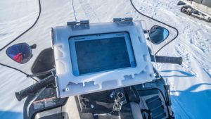
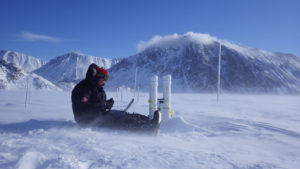
SmartICE Pilimmaksaqniq Sikulirijimik/Operator Training Program
In this course, the learner will receive training for the SmartQAMUTIK equipment that SmartICE operators use to monitor the sea-ice.

Pre-Employment
This course is to be utilized as a learning tool for job seekers looking to gain information about constructing an effective Resume